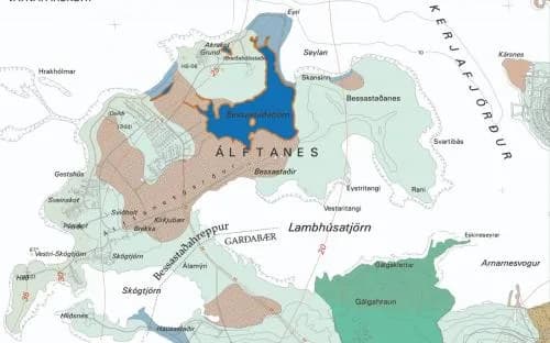
The first draft of a standard for surficial-geology maps in Iceland was presented at the National Energy Authority (Orkustofnun) in 1978. Through 1980–1990 the standard was continuously developed as experience with such mapping grew. The ArcInfo GIS was adopted at Orkustofnun in 1992–1993 and since 1997 all geological maps have been produced digitally. With that change the standard was overhauled again, and the version presented here is geared to digital cartography in the ArcInfo GIS.
The standard is built from primary symbology and secondary symbology.
Primary symbology shows the main features and covers the whole mapped area. It is of two kinds: area-filling colours for sediment type and exposed bedrock, and lines and symbols for local landforms, often shown selectively.
Secondary symbology provides additional information where it is available and considered necessary. It shows a finer classification of sediment, such as facies, grain size or thickness where these are known.
Numbers for colours, lines and symbols refer to ÍSOR's catalogues.
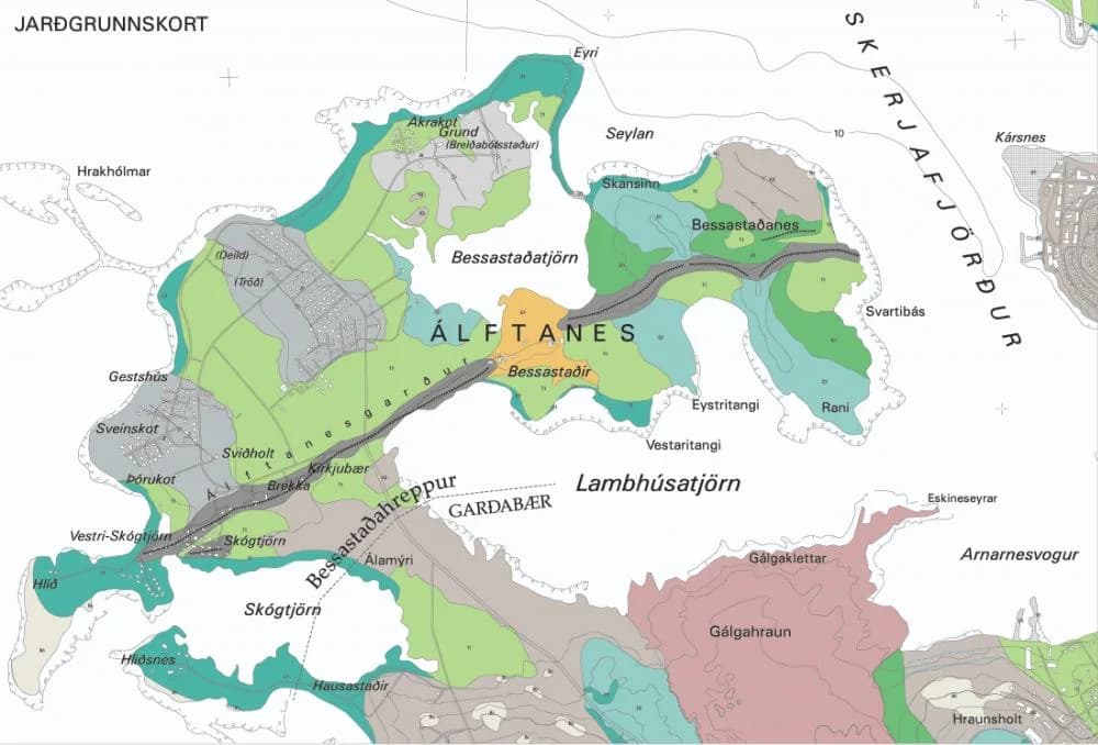
Surficial-geology map standard (PDF)Primary symbology
Area-filling colours for sediment type, distinguishing the different map units on the basis of the sediment's origin. Each sediment type is additionally identified by a specific label, i.e. a letter code.
Area-filling colours for exposed bedrock and recent (post-glacial) lava, also identified by a label — a two-letter code for bedrock and a three-letter code for recent lava.
Symbols and lines for various landforms, often marked on maps selectively.
Secondary symbology
Black symbols on the colour of the relevant sediment type, marked where observations have been made.
- Symbols for the dominant grain sizes in sediment.
- Thickness of unconsolidated deposits.
- Letter codes for unconsolidated deposits. Can be used to mark small sediment patches too small to show their extent, in areas where another sediment type or bedrock dominates.
- Letter codes for bedrock. Can be used to mark individual rock exposures on a sediment surface.
- Letter codes for mapped recent lava.
Map standard for hydrological maps
Hydrological maps
The first Icelandic hydrological map was drawn at Orkustofnun in 1972 — Guttormur Sigbjarnarson's map of the Þórisvatn area. Standards and symbols for hydrological maps have evolved since then, long taking their cue from international maps and mapping methods. The main early model was the International Hydrogeological Map of Europe (1:1,500,000), whose Iceland section was published in 1980. Orkustofnun then commissioned an Icelandic standard for hydrological maps, published in 1984 (ÁH and FS 1984: Proposals for a hydrological-map standard, OS-VOD 1:50,000). The standards have changed considerably over the years. There are more permeability classes on Icelandic maps than on foreign maps, and many new map symbols have been introduced that reflect the country's distinctive nature, especially regarding geothermal areas and glacial rivers, fire and ice.
The ArcInfo GIS was adopted at Orkustofnun in 1992–1993 and since 1997 all hydrological maps have been produced digitally. The version of the hydrological-map standard presented here is geared to digital cartography in the ArcInfo GIS.
Hydrological map standard (PDF)The standard is made up of five categories of symbology:
- A permeability map showing the permeability values of the strata.
- Hatching showing the strata at the surface.
- General geological symbols, chiefly relating to tectonics and volcanism.
- Hydrological symbols showing, for example, springs, geothermal features, surface-water divides, groundwater divides, geo-seawater and much more.
- Infrastructure, chiefly relating to hydrology, hydrological research and water use — e.g. water sources, boreholes, water-level gauges, hydropower stations, swimming pools and more.